The Point, Emerald Isle, 5 July 2017

I did some volunteer data and editing work for the North Carolina Coastal Federation a while ago. Kelly Bodie, the membership director, invited me for coffee at Weaver Street last week to talk about one of their mailings. I mentioned how discouraged I was by the decline in bird life on the coast. Once upon a time there were numerous sanderlings and sandpipers, laughing gulls and herring gulls, egrets and cranes, and spectacular pelican flyovers several times a day, like this one, 15 pelicans and a tern over Oak Island, April 2011.

Screenshot 2017-07-06 10.59.29

One culprit, as I understand it, is so-called beach replenishment, in which sand dredged from the ocean floor is blown through large pipes onto the beach in an attempt to replace sand lost by erosion. You don’t have to be an expert to know it’s a losing battle. One result is that dredged sand gets in the gills of fish and suffocates them, eliminating a food source for the birds. I don’t know if there’s a connection, but we no longer see the boats that used to fish for menhaden off Bogue Banks.

In any case, Kelly sent me a link to a Coastal Federation publication about an effort to protect least tern and Wilson’s Plovers at the west end of Emerald Isle, known as The Point. (I went there as part of my walk in 2011, and was treated to a pelican flyby. I believe this video, which I made, shows least tern (so called, I guess, because they are the smallest tern, with 20 inch wingspans).

They’re hardly visible, but you can catch glimpses, and hear their distinctive chirp, which The Sibley Field Guide to Birds of Eastern North America describes as “keeDEEK or piDEEK-adik.” Wilson’s Plover, according to Sibley, is about the same size, with 19 inch wingspans. Both birds nest on sandy beaches and sandflats. I couldn’t get any closer to Bogue Inlet than this sign:

IMG_2635

Unbeknownst to us, there are least tern all around our rental apartment at Emerald Cove, 15 or so miles from Bogue Inlet. We hear them keeDEEKing and/or piDEEK-adiking in the evenings and see them racing back and forth on whose knows what errands. Hunting insects? Kelly had warned me that colleagues told her the mosquitoes this year are especially bad, but we haven’t encountered any. In our continual quest for an AC-free lifestyle, we have the sliding doors open and the front door cracked to let in cross breezes, and have neither flies nor mosquitoes.

Shackleford Banks, June 2017

shackleford mapShackleford Banks (on some maps Shackleford Island) is a 9-mile-by-1 mile barrier island a 15-minute ferry ride from Beaufort NC. Part of the Cape Lookout National Seashore, the island is the year-round home of one hundred feral horses, uncounted scallops, crabs and other sea animals, the summer nesting ground of loggerhead turtles, and a magnet for beach day trippers and campers, some of whom take the ferry, more of whom come in their own boats.

1

Trisha and I went to the Cape Lookout Lighthouse a number of years ago, before I began Going Coastal, taking a ferry from Harkers Island. It was one of our first, if not the first, encounters with North Carolina beach drivers, and in considering going back to add it to my coast cards, I weighed my dislike of the species. Shackleford Island, though, looked intriguing. A few years ago, Trisha and Lily and I, and Lily’s Pardes Institute of Jewish Studies classmate and for a time boyfriend Micah, took a short ferry ride from Beaufort to the nearby Rachel Carson Reserve on nearby Bird Shoal. (Somehow there are no digital photographs from that outing, although there are prints, one in a frame in my study at home.)

I spent the weekend of June 2-4 at an AA Gratitude Retreat at the Trinity Center in Pine Knoll Shores and am as I write this in the first day of an additional four-day stay at the center. With rain in the forecast for the next two days, I decided to go to Shackleford Banks today to walk at least a few miles, in keeping with my new limited ambitions. Today is a Sunday, so I shouldn’t have been surprised to have so much company on the island. Somehow, though, the name had connoted isolation. Maybe I conflated it with what I know about Ernest Shackleton. (If you follow that link to another of my blogs, scroll down to the paragraph beginning “I’ve been reading…”)

There were people everywhere, but scrunched up along the shoreline, so they hadn’t had to lug their coolers and chairs and umbrellas more than a few feet. I’m not telling you how to live your lives, people, but come on. This is what people do at Coney Island, and they get there on the subway.

Version 2

These folks at least camped out, but not very far away from everyone else.

Version 2

The land on the horizon is Fort Macon State Park, on Bogue Banks near Atlantic Beach, not far from where I started out. The water between is Beaufort Inlet. The inlet is a couple of hundred yards across, but where I was standing was 13 road miles plus a ferry ride away.

The current in the inlet—as in most North Carolina inlets I’ve seen up close—was very swift. This skillful kayaker worked the current impressively, paddling in to the whitecaps, doing a 180, and hanging there for well over a minute.

1 (3)

The ferry captain and mate said they hadn’t seen any horses that day, but they often came to this pond. So I guess you can’t tear wild horses away from where all the people are.

Version 2

There were the usual scavenger gulls, and these these more creative ibises.

1 (4)

I thought I was there at a fairly low tide, but there was very little shore to walk on to get away from the crowd, and I ended up heading back on the ferry half an hour sooner than I’d planned. I can hardly call what I did a walk, but there you have it. There are ferries to the east end of Shackleford from Harkers Island, so I may take a look out there in July when Trisha and I take our regular trip to Emerald Isle.

1 (5)

If you like placenames as much as I do, you’ll enjoy the names of these islands off the east end of Shackleford: Baregrass, Sheep, Blinds Hammock, Great Marsh. And the waterways between them: Sheep Island Slue, The Ditch. That’s Shackleford on the lower left of this map, Cape Lookout on the right.

Cape Hatteras National Seashore, 31 March 2017

Well, here’s what happened. While rehabbing from my hip replacement, I was aware that it was hard to move my feet quickly. Throughout the summer of 2014, I resumed my walking routine, both on streets and on trails, and rode a comfort bike 10 or so miles a couple of times a week. I didn’t have any pain or other problems, but I was definitely slower than I had been.

In March and April of 2015, Trisha and I went to Ireland and Scotland to celebrate our 25th wedding anniversary. I had trouble walking fast, especially on ancient cobblestone streets, and was uneasy on rugged rural paths. It was especially troubling because Trisha and I have run and walked all over the world in our time together, and I could no longer keep up.

On returning home, my family physician assistant, Beth Edwards, asked me to do some tandem walking, where you put one foot directly in front of the other. I nearly fell over. She referred me to a neurologist, Dr. Thomas Kirk, at Raleigh Neurology, who ordered an MRI of my brain, a nerve-conduction test, and a neuropsychological evaluation. All of that took a couple of months, after which Kirk tentatively diagnosed normal pressure hydrocephalus, which I won’t bother to define because it was wrong and because having diagnosed it Kirk proposed no treatment. Kirk is a cold, cerebral doctor who sat behind a computer keyboard when he consulted with me and who didn’t seem at all disturbed that I didn’t make any more appointments.

By this time, it was August 2015. In early September, I got out of bed early one morning and couldn’t walk or crawl. I managed to get back in bed and fall asleep and in the morning Trisha took me to the ER at UNC Hospital. Many hours later, I left with a diagnosis—a urinary tract infection—and these words from one of the ER doctors: “Neurology wants you.” A smart, charismatic neurology resident, with the spectacular name of Danoushka Tememe, observed my gait difficulties and got me connected with her attending, Dr. Daniel Roque, who diagnosed Parkinsonism, “a group of neurological disorders that cause movement problems similar to those seen in Parkinson’s disease, such as tremors, slow movement and stiffness,” in the words of one Web site. His prescription: vigorous exercise and a round of LSVT Big therapy. A sensational physical therapist, Hilary Rose, devised a set of workouts that considerably improved my movements and increased my confidence about getting around in the world.

Dr. Roque turned me over to a senior colleague, Dr. Daniel Kaufer. After a rough start with him, Trisha and I are both big fans. He refined the diagnosis to “atypical Parkinsonism,” which he said to us is “meaningless,” took me off the medication he’d initially prescribed (carbidopa-levidopa), and put me on Huperzine, a processed form of a Chinese herb, club moss, and ordered another round of LSVT, which I’m taking as I write this, in April 2017.

A further update: In May 2017, Dr. Kaufer revised my diagnosis to apraxia, from the Greek “inability to move.” Here’s what it says on WebMD: “Apraxia is a poorly understood neurological condition. People who have it find it difficult or impossible to make certain motor movements, even though their muscles are normal. Milder forms of apraxia are known as dyspraxia.

“Apraxia can occur in a number of different forms. One form is orofacial apraxia. People with orofacial apraxia are unable to voluntarily perform certain movements involving facial muscles. For instance, they may not be able to lick their lips or wink. Another form of apraxia affects a person’s ability to intentionally move arms and legs.”

My particular problem is an inability to move my feet quickly. I’m doing drum rudiments for therapy. Kaufer has noticed that my symptoms haven’t gotten worse since since I started seeing him, and suggested they might not.

There you have the state of my body when I stepped out on the sand at Coquina Beach.

IMG_1893

For a number of reasons—my health, my unhappiness over the issue of driving on the beach, and a feeling that it might be better to be less obsessive about my project—I decided not to try to walk nearly every mile of every leg of the coast, but to settle for a few miles on each stage.

There’d been drivers here, for sure:

IMG_1897

And careless people who forgot their beach chairs:

IMG_1899

And then for some reason north of the unspoiled part of the seashore, there was this:

IMG_1907

A friend of mine, a Virginian (where driving on the beach is prohibited) says I should just accept that drive on the beach is what North Carolinians do.

A short drive from Coquina Beach, across NC12 on the Roanoke Sound of the barrier beach, is the Bodie (pronounced “body”) Island lighthouse, which actually guards Oregon Inlet, over two miles away to the south, and was placed where it is because of the natural migration of the inlet.

IMG_1923

The next day, Trisha and I went a little farther south to Pea Island National Wildlife Refuge, which has hundreds of bird and animal species, according to guidebooks, of which we saw almost none, except for these turtles:

Version 2

1

Version 2

1 (1)

As hip as can be

new hip x-rayMy hip replacement, courtesy of Dr. Paul Lachiewicz (pronounced La-KEV-itch), was a big success. The pain of the arthritis vanished immediately and the post-surgical pain was gone the Monday after my Friday operation—the result in part of a vitamin and supplement regimen I went on at the suggestion of a couple of friends. I spent six weeks on a pair of arm crutches, walking for two weeks just in the house, then graduating to longer and longer walks around our development. These days, two months after the operation, I’m walking two miles a day, 4-5 times a week. I’m weak and slow, no doubt about it, but the absence of pain is a gift.

To get out of the house, and to give Trisha a reward for all the nursing work she did without complaint, we went to Wrightsville Beach over Easter weekend. The weather was miserable, cold and rainy, but we had a nice time, watching episodes from the third season of “Borgen” on a laptop.

I’d walked Wrightsville in January 2012, so I merely wanted to see what it felt like walking on sand. We did the short walk from our hotel to Masonboro Inlet on the sand, then walked back on the road. The going was good, even on the softer sand, but the annoyance, once again, was the beach replenishment project that was underway. As always, they’re just dreaming, at great expense. The photos are a bulldozer moving pipe alongside the Oceanic Restaurant and a dredging barge in the Cape Fear River.

I doubt I’ll be back on the beach in a serious way until this winter, at the earliest.

WB bulldozer


WB dredger


Hip Hiatus

Trisha had a business trip to Asheville in September and I went along for the ride. I walked around the very hilly town for several hours one morning and afternoon and by the end of the day I was in a lot of pain. I thought it might be the result of a newish pair of nearly zero-heel shoes, but it was probably the last of the cartilage in my right hip giving out.

hip xrayI’d known for years that there wasn’t much cartilage left. This x-ray is from May 2011, shortly after I injured my hip kicking the top step of a flight of stairs and nearly losing my balance. I injured the same hip during my brief soccer career in 1998, when I had so much fun I overdid everything, in particular took a ball out of the air and redirected it for a practice goal, a maneuver that had so much impact it rattled my teeth. You can see the white arthritis patches on both hips and how little spacing there was between femur and pelvic acetabulum (I’m getting to know the lingo) even then. I can’t open my current x-ray on my Mac, but there’s no spacing at all now, just bone on bone.

It took six weeks to get a diagnosis from an osteopath, three weeks to get a referral to an orthopedic surgeon neither Trisha nor I liked, another three to get another referral to one we did, Dr. Paul Lachiewicz (pronounced Luh-CAV-itch), who is going to do a total hip replacement on Valentine’s Day. I’ll be in Durham Regional Hospital for three nights, on arm crutches around the house and close by for five to six weeks, able to drive after eight weeks, walking without a cane after 12 weeks, riding a bike after six months. I have a friend with a new hip who plays racquetball, so I hope to be playing tennis by mid-summer and back walking the coastline by fall. These days I’m doing my walking in chest-deep water in a swimming pool, which gets my heart going and is keeping me sane. This is the longest I’ve gone in my life without five or six days a week of vigorous exercise, which I suppose is why I’m in this fix in the first place.

Until the fall.

Bald Head Island (sort of)

Sunset Beach, which I walked to begin my coastal trek project in October 2010, is the southernmost beach community in North Carolina. Bird Island State Reserve, at the western end of Sunset Beach, is truncated by the North Carolina-South Carolina border. The southernmost land mass in North Carolina, however, is Cape Fear, on Bald Head Island, 33 miles east of Sunset Beach as the crow flies, at 34.2300° north latitude. Bald Head Island, however again, is not an island; it is the southernmost portion of the Smith Island Complex, a peninsula dividing the Atlantic Ocean and the Cape Fear River and comprising Bald Head Island, Bluff Island, Middle Island, Striking Island, and Battery Island, some of which are true islands, some not.

Map courtesy of Glenn Morris's North Carolina Beaches.

Map courtesy of Glenn Morris’s North Carolina Beaches.

In March 2013, I walked Carolina Beach and Kure Beach, going as far south as Fort Fisher. The plan was to finish off the nine miles or so from Fort Fisher to Bald Head in September, on the weekend trip Trisha and I take every year after the annual conference of the North Carolina Center for Nonprofits. As we’d done at Topsail Island after last year’s conference, we planned to cover the distance on our bikes, which obviated the need for a driver to drop us off or pick us up. As they say, Man plans, God laughs. The first stumble was the cost of accommodations on Bald Head, which is a private resort community. We decided we’d stay instead at a B&B in Southport, on the mainland, a short ferry ride away from Bald Head. On the Tuesday before we drove out, I checked the ferry schedule and rates and was stunned to read that a roundtrip from Southport to Bald Head and back costs $25. Each. Bicycles are another $25. Each. We’d actually stayed on Bald Head at Thanksgiving 1999–Trisha, Lily, and I, and Rob and Micky (very pregnant with Nico), Laurie, and Kip–and I don’t remember being robbed to such an extent. Fourteen years, I guess, makes a difference.

A little more research revealed that the ferry from Southport to Fort Fisher–a state-run ferry versus the private Bald Head operation–costs $2 one-way for passenger and bicycle. Each. So after breakfast on Sunday, we rode the two miles to the ferry landing, took the 20-minute ride across the Cape Fear River, and rode across to just south of Fort Fisher to begin our ride south. We jagged in a little too soon and had to push our bikes through soft sand for more than half a mile, then discovered that this stretch of beach is yet another one of those that allows internal combustion-powered driving in the off-season. I’ve had about enough of that, thank you, and if I keep encountering it on my would-be walks, I’ll just forget the whole project. I can walk down the middle of a street any time I care to without leaving Chapel Hill; I don’t need to go to the beach to encounter traffic, especially enormous SUVs and trucks.

Trisha eyes the beach traffic.

Trisha eyes the beach traffic.

It was threatening rain and so we rode back to the ferry and crossed over to Southport. Southport is a small port town on the scale of and with the feel of Beaufort, which we enjoy visiting every summer. The shops sell mostly junk masquerading as antiques, although there’s a nice enough coffee shop, Port City Java, that has the virtue of opening early and staying open late. There are no restaurants–or at least we didn’t find one–of the quality of Beaufort’s Front Street Grill, and the harbor is funkier than Beaufort’s.

I doubt we’ll go back to Southport and I certainly doubt that I’ll take another crack at Bald Head, although I’m curious about the whole issue of who owns the beach. I’ve heard myself and others say something along the lines of: the beach between and median high- and low-tide lines belongs to the public, and those who use it aren’t trespassing. But I’m not really sure of that. I belong to an organization called Surfrider Foundation and I got an e-mail from them recently describing a public-private standoff on a stretch of beach in California. Click here for a short film about the issue that alludes to other disputes elsewhere around the country.

The fact is, I’d like to go back to Bald Head, if for no other reason than to pee on their fucking sand. I feel similarly about Figure Eight Island, north of Wrightsville Beach, which is protected by a private drawbridge and causeway. Protected from you and me. Glenn Morris’s North Carolina Beaches states: “The security and isolation make the island attractive for celebrity vacationers.” To which I say, “Celebrity this.” Morris frequently makes the point that communities that get public assistance to replenish beaches after storms have an obligation to provide public access to those beaches. I wish they also had an obligation not to pollute those beaches by allowing driving on them.

Oh, yeah, one more thing. Getting ready to head out on Sunday morning, I discovered some schmutz in my fanny pack and passed it to Trisha to shake out over the bathroom toilet. I neglected to zip up the outside pocket and she unwittingly shook my camera into the toilet. The moisture apparently killed it instantly. Good riddance. I’ve hated the camera, a Canon Powershot A1400, from the moment I got it to replace a far superior earlier Powershot, which was one of the best cameras I’ve ever owned. The A1400 has AA batteries, instead of a rechargeable lithium ion battery, which is insane and which makes the camera much bulkier. Its only virtue is that it is the last of the point-and-shoot cameras with an optical viewfinder. Trisha brought her iPhone and she made some nice pictures, including this of a pelican hangout in the Cape Fear:

photo 4-2

13th Leg: Carolina Beach and Kure Beach

stickers

Carolina Beach

March 8, 2013
5.12 miles
2.8 mph moving average
1 hour 54 minutes

Kure Beach

March 9, 2013
4.93 miles
2.6 mph moving average
2 hours

10.05 miles over two days, 1.5 of them overlapping. A beautiful, cool weekend. Terrain that was partly familiar, partly new. Beaches and beach towns that were a little bit disappointing, a little bit depressing.

truckDepressing because there is nothing that makes me sadder than a sight like this. I don’t understand what makes people want to drive on a beach. If they drove Honda Fits and Mini Coopers, a beach full of them might be kind of fun, but what they drive are gigantic SUVs and F1- and 2- and 350 trucks and they’re no fun at all. On top of the driving (which to be fair was only at the north end of Carolina Beach), there were two U.S. Army Corps of Engineers beach replenishment projects underway, one at Carolina Beach, one at Kure Beach. Back hoes, graders, giant lengths of pipe on behalf of an effort to dredge sand from two so-called “borrow areas” and pump it under high pressure onto beaches in the two communities. The beaches are seriously eroded, with high tides that run right up to sheer dune faces.

back hoeOne borrow area is in Masonboro Inlet, between Carolina Beach and Masonboro Island, an undeveloped National Estuarine Research Reserve island reachable only by boat. According to Glenn Morris’s invaluable North Carolina Beaches, Masonboro Island may be the island sighted by Giovanni da Verrazano in 1524, the first land in the Americas seen by a European explorer. The other borrow area is off the Freeman Park section at the north end of Carolina Beach; that sand will be pumped on to two sections of Kure Beach. According to the Port City Daily of Wilmington, NC, the total project involves 1.8 million cubic yards of sand and will cost $26 million.

stairsI can tell you right now, folks, it won’t make a bit of difference. These stairs and this sheer eroded dune face are the remnants of some replenishment project past, a project that mainly benefitted the carpenter who built the stairs and who will have to repair them before the summer season begins. Our beloved Emerald Isle is scheduled to dump 630,000 cubic yards of sand along approximately 4.1 miles of beach, including the stretch we’ll be lying on in July. The last replenishment, several years ago, dumped what I’d call dirt, rather than sand, full of sharp stones and rocks that were painful to walk over without sandals or beach shoes. Much of the Emerald Isle dirt has been washed away by winter storms. Man plans, nature laughs.

don and meMy driver for these mini-legs was my good friend Don Stewart, with whom I traveled through 900 miles of his native Texas exactly a year ago. Don has knee issues, so he walked only a stretch of beach each day, although he did manage to get a sensational sunburn. We were both surprised at the lack of enterprise in the two towns. Carolina Beach has a long stretch of fast food places and gas stations, while Kure Beach is little more than a stop light and a convenience store. Both towns have fishing piers, but Carolina Beach’s was closed and Kure Beach’s was undergoing renovations. The Kure Beach pier was built in 1923 by L.C. Kure, son of Hans Kure, a native of Denmark who ran a ship chandler and stevedore business in Wilmington. The pier, whose motto is “Man, you should have been here last week,” is said to be the oldest fishing pier on the East Coast. It  has been rebuilt several times after hurricanes.

SDon was a Gulf of Mexico surfer in his youth and I never miss a chance to watch surfers, so we were pleased to see that a surfing contest was under way on Saturday morning. Later that day, Don picked me up at Fort Fisher, south of Kure Beach, and we watched surfers there. I’d been kicked off the beach by the USACE crew and simultaneously developed a blister, the result of wearing my Chaco hiking sandals for the first time this season without an adequate break-in period. I therefore stopped short of my goal, which was to go another couple  of miles south of Fort Fisher. I’ll make that up another time, perhaps when Trisha and I go together to Bald Head Island, which is actually not an island but part the peninsula that contains Carolina and Kure Beaches and that is known in real estatese as Pleasure Island.

fly trap loopOn Sunday morning, after pancakes at Kate’s Pancake House in Carolina Beach, pretty much the only breakfast spot in town, we stopped on the way out  of town at Carolina Beach State Park. We happened by chance onto Fly Trap Loop, a short trail through a boggy area, then got back in the car and drove to a marina overlooking the Cape Fear River, which is part of the Wilmington harbor. Only after heading home and getting out the Morris book did we discover that Fly Trap Loop is populated by Venus flytrap plants, which are found, according to Morris, “only within a 75-mile radius of Wilmington and nowhere else in the world.” They don’t flower until May, so we can be excused for not spotting them.

Click here to see more photos. Click on “slideshow,” over on the right hand side. Picasa has changed the way slideshows display, and I can’t find a way to slow down the speed of the show. If it moves too fast for you, just go back.

12th leg: Surf City-Topsail Beach

Surf City-Topsail Beach

September 16, 2012
9.6 miles
moving average 8.4 mph

No, I wasn’t sprinting. I cheated a little, riding my bike along the beach so that Trisha could come along on this leg rather than having to be my drop-off or pick-up driver.

Trisha finished her annual North Carolina Center for Nonprofits conference on Friday afternoon and I picked her up, bikes aboard, at the conference hotel in Durham. We made it to the mainland side of Surf City by 6, in time to have dinner at a so-so restaurant by the swing bridge that carries NC 50 over to Topsail Island, one of the last such bridges in the state and apparently doomed, according to this NCDOT Web page. The swing bridge at Sunset Beach was replaced just after I walked my first leg there in October 2010, by a hideous flyover monstrosity. All so that drivers don’t have to wait for sailors on the Intracoastal Waterway.

Topsail Island, which extends from New River Inlet, at Camp Lejeune, southwest to New Topsail Inlet, is 22 miles long, three miles less than Bogue Banks, the North Carolina coast’s longest island, which I finished walking in July. It comprises three communities — North Topsail Beach, Surf City, and Topsail Beach — and crosses two countries, Onslow, to the north, and Pender. Our motel, the Island Inn, is in the heart of Surf City, not far from the scene of an unusual adventure last September, following last year’s NCCNP conference. That year, we stayed at a VRBO on the mainland in Surf City, and woke on Saturday to rain and cool temperatures. We ended up spending most the day indoors, and finally went out in late afternoon when the skies cleared. There wasn’t time for a long walk, but we drove over to the island and walked a couple of miles on what little beach there was at high tide. It warmed up enough that Trisha took off her sweatshirt and tied it around her waist. Our car key was in a pocket. And then it wasn’t.

What to do? We walked back up the beach a ways, but talk about a needle and a haystack. So we went back to a bar by the Surf City Fishing Pier to borrow a phone. Quick lesson learned: if you want the number of a police department, ask a local bartender. The woman bartender knew the number by heart. We called the cops and while we waited Trisha ordered a gin and tonic and I a tonic and tonic. They were served in plastic cups. After 10 minutes or so, we walked outside to meet the cops. Waiters came running at us from every direction, saying “You can’t take those drinks outside!” We sort of lied and said both of us were drinking tonic, so they let us go. We crossed the street to where we’d parked. The cops drove up and a male cop got of the passenger side, a woman cop out of the driver’s side. First thing the male cop said: “What’s in those glasses?” I said “Tonic water,” and finished mine and tossed Trisha’s — I’d been holding both cups — onto a patch of sand that quickly drank down the evidence.

The cops opened the car with one of those inflatable pad deals. Fortunately, Trisha, I discovered, travels with a spare car key, so one of us had to go back to the house with the cops. Since she had gin on her breath, I was elected. Another lesson learned: the back seat of a police car is no place to travel. It’s impossible to sit with your feet flat on the floor, except in a ballet dancer’s first position. Fortunately, the cops kept the sliding glass window between us open so we could chat. Reached house, got key, returned to the scene of the “crime,” thanked the cops, paid the $10 car entry fee the town charges, end of story. I’d had visions of having to call someone in Chapel Hill and asking them to retrieve a key from our house and drive three hours to the beach and three hours back. Or of taking a three-hour taxi ride then driving Trisha’s car three hours back.

This year, we slept late, had breakfast at the New York Deli, coffee at the Daily Grind, and set out around 1 for what turned out to be a 19.2 mile roundtrip bike ride. The weather was beautiful, bright blue skies with temperatures in the low 70s and a light wind that somehow managed to be in our faces in both directions. The beach was surprisingly crowded and people looked at us oddly, as though maybe it’s illegal to ride a bike on the beach. A little girl pointed us out to her mother — “Mommy, they’re riding on the beach” — meaning they’d had the discussion.

We rode at low tide so the beach was wide and flat, but the high-water line is right up to the face of the dunes, which in many stretches are non-existent. The public-access steps to the beach are very steep in many places, another indication that the dunes are perilously balanced. Surf City and Topsail Island were hard hit by Hurricane Fran in September 1996, and three fishing piers were destroyed and many houses damaged. The Surf City Fishing Pier and the Jolly Roger Fishing Pier, in Topsail Beach, were rebuilt.

Topsail Island was unpopulated until the late 1940s and could be reached only at low tide by fishermen and by farmers who grazed livestock on the island. After World War II, Topsail Island was the site of Operation Bumblebee, a series of tests of U.S. Navy rockets. Rocket flights were monitored from seven concrete observation towers, a couple of which survive. Others have been renovated and converted into dwellings; our Chapel Hill friends Mike Schlessinger and Nadine Waurin (and Mike’s sister Julie and her husband Ben and their sons Max and Sam and grandson Oscar) were vacationing in one of these renovated structures when we visited and we spent a pleasant evening in what was once Tower No. 9.

Our ride took us to New Topsail Inlet, which separates Topsail Island from Lea-Hutaff Island, an uninhabited island that was once two islands now joined by shoaling sands. According to Glenn Morris’s North Carolina Beaches, 40 building lots were platted on Lea-Hutaff (the islands were named for their owners) in the 1980s. Only one structure was built and can be seen from the Topsail Island side of the inlet. According to Morris, “the island has never had any severe disturbance by man and is considered one of the last and best undeveloped barrier islands on the North Carolina coast.” The island can be reached by boat and we spotted a number of visitors across the inlet.

Getting to and from Topsail Island involves driving on US 17 or NC 50 through what Morris calls “tangled, impenetrable woods” and “immense roadless areas.” These areas are game lands managed by the North Carolina Wildlife Resources Commission. Angola Bay, in the northeast part of Pender County, comprises 22,600 acres with only a few fire roads. Holly Shelter, in east-central Pender County, comprises 22,600 acres managed for big game and waterfowl hunting. US 17, a five-lane road that was once two, passes through Hampstead, which Morris says was once “a whisper of a community” where “[m]oss-draped trees, some with an arching reach across the road, crowded and enclosed this passage where the highway speed limit dropped to 45 miles per hour as though a mark of respect.” No más. And in fact, NC 210, the main road through Topsail Beach, would be a perilous place to bike were it not for a several-mile bike path. The only way in and out of Topsail Beach, it would be no fun, in high summer, to try to make a left turn along this stretch.

Click here for total mileage update.

Click on the picture to see more pictures. Then select “slide show” and set the time between images at 10 or so seconds.

Surf City and Topsail Island

11th leg: Atlantic Beach to Fort Macon

Atlantic Beach-Fort Macon

July 12, 2012
4.6 miles
Moving time: 1.41
Total time: 1:53 minutes
Moving average: 2.7 mph
Overall average: 2.4 mph

Overheard outside the men’s room at Fort Macon Museum, one 40-ish white man to another, both with kids in tow, pointing to a sign stating that concealed hanguns are prohibited in the museum:

“Liberals just don’t get it. If I had a concealed handgun, the last thing I’d do is leave it here on the ground when I went inside to take a leak. Are liberals just stupid, or do they really think that way?”

Not the food for thought I might have hoped for on completing the fourth and last stage of my walk of 25-mile-long Bogue Banks, but it didn’t diminish my feeling of accomplishment.

As in the previous stage, I used car and bike to set up the walk, driving (after breakfast at the 4 Corners in Atlantic Beach) to Fort Macon, then riding my bike back to the Atlantic Beach town beach and walking back to the fort. The weather had turned from intensely hot on Tuesday evening and there were thunderstorms and overnight rains the last two nights, with more storms and rain forecast for this afternoon, a Thursday. The day dawned cool and cloudy and I considered postponing the stage until Friday, when the forecast was slightly improved. It sprinkled as I drove down to AB, but by the time I made the car-bike roundtrip to the fort and back, the skies were clear, with rain clouds on the horizon and thunder booming occasionally throughout the walk.

I was impressed with the beginning of the east end of AB, with its classic beach houses, big but not too big. I especially liked this A frame, whose living rooms are on the lower level and whose upper level is simply a deck with a door to the interior. This section of homes gave way to a section of condos, some not so bad looking, some hideous.

Development ends abruptly at the entrance to Fort Macon State Park, 385 acres of beach, dunes, and maritime forest that continue to Beaufort Inlet at the east end of Bogue Banks. At the southeast corner of Bogue Banks is a stone jetty that was designed by and constructed under the supervision of Robert E. Lee, a recent West Point graduate stationed at the fort in the 1840s.

What follows is from the Fort Macon Web site:

The War of 1812 demonstrated the weakness of existing coastal defenses of the United States and prompted the US government into beginning construction on an improved chain of coastal fortifications for national defense. The present fort, Fort Macon, was a part of this chain. Fort Macon’s purpose was to guard Beaufort Inlet and Beaufort Harbor, North Carolina’s only major deepwater ocean port.

Construction of the present fort began in 1826. The fort was garrisoned in 1834. In the 1840s, a system of erosion control was initially engineered by Robert E. Lee, who later became general of the Confederate Army. At the beginning of the Civil War, North Carolina seized the fort from Union forces. The fort was later attacked in 1862, and it fell back into Union hands. For the duration of the war, the fort was a coaling station for navy ships.

Fort Macon was a federal prison from 1867 to 1876, garrisoned during the Spanish-American War and closed in 1903. Congress offered the sale of the fort in 1923, and the state purchased the land, making it the second state park. Restored by the Civilian Conservation Corps from 1934-35, the fort was garrisoned for the last time during World War II.

Inlets are usually special, with so much natural energy produced by tides and currents and winds. Beaufort Inlet is particularly wonderful, with its vista of Shackleford Banks, Harkers Island, the town of Beaufort on the mainland, Radio Island to the west of Beaufort, and the Morehead City industrial and commercial waterfront.

Click here for my updated total mileage.

Some photos. Click on the picture, select “slideshow,” change timing to 10 seconds or more.

Atlantic Beach-Fort Macon July 2012

10th Leg: Atlantic Beach to Iron Steamer

Atlantic Beach to Iron Steamer
July 9, 2012

Total distance: 5 miles
Moving time: 1:50
Total time: 1:57 (an indication of how tough it was [see below]; I didn’t even want to stop to rest more than for a quick bite of peanut butter sandwich about halfway through)
Moving average: 2.7 mph
Overall average: 2.6 mph

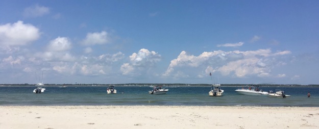
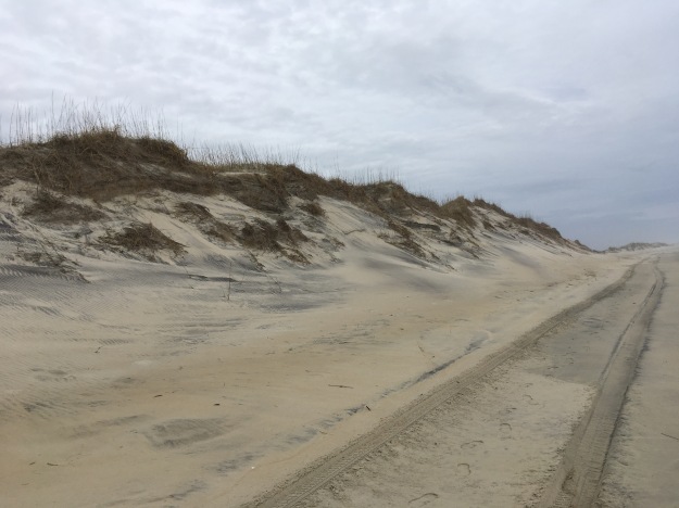
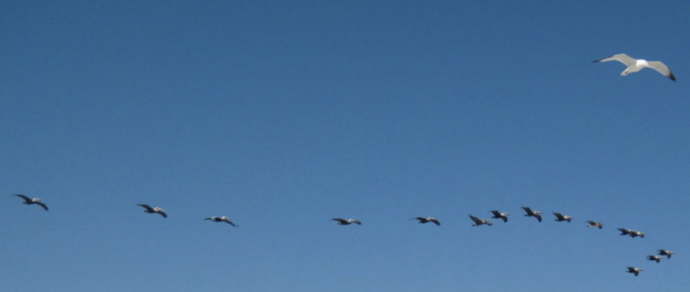
The wind’s been blowing dead solid from the west at about 20 miles an hour ever since we got to Emerald Isle on July 1 and today I walked directly into it for five difficult miles, made more so because I miscalculated how rapidly the incoming tide would rise and had to walk askew for more than half the distance, that distance being from the Atlantic Beach downtown regional access west to Iron Steamer Regional Beach Access in Pine Knoll Shores.

With some nine miles left to go to finish off the island of Bogue Banks, I divided the last leg into two, of which today’s was the first. I was very grateful to have made that decision, because today’s walk was easily the most difficult leg so far. The wind was the main culprit, then the cant of the beach, but I’m also in worse shape than I was a year ago, when I felt as strong as at any point in my life. Two colds, one in November that wouldn’t quit and eventually developed into walking pneumonia, and one a month ago that I caught as it was making its way around the Obama for America office in Chapel Hill, where I’ve been volunteering, kept me from training and maintaining walks of sufficient length.

(If my writing seems a little archaic, it may be my recent reading, especially Hillary Mantel’s “Wolf Hall” and Thomas Pynchon’s “Mason & Dixon,” both wonderfully stylized.)

Because of the distance involved, I didn’t need to ask Trisha to chauffeur me at one end or the other. I loaded my bike on the Fit and drove from Emerald Cove (where we’re staying for the third year) to Iron Steamer, where I parked the Fit, significantly, for free, this being the first year in our experience that the communities out here are charging parking fees on weekends and holidays and some other days, a violation, in my eyes, of the agreement the communities made to provide beach access in exchange for federal beach replenishment. I rode the five or so miles along NC 58 into Atlantic Beach (the wind at my back) and locked my bike to a bike rack by the town beach.

Atlantic Beach, according to Glenn Morris’s “North Carolina Beaches,” was a dancing and music center in the late 19th and early 20th centuries, especially after the completion in 1928 of the bridge linking it to Morehead City, known as the High Rise Bridge. The extension in the 1950s of NC 58 joined Atlantic Beach with Emerald Isle, Indian Beach, and Pine Knoll Shores, but Atlantic Beach has a very different feel from those communities, that of a classic beach town, a little bit honky-tonk, a little bit seedy, but very charming.

According to Morris (whose book was updated in 2005), AB (as it is known locally) was the beneficiary in 1986 of sand from a spoil island in Beaufort Inlet, and the town built sand fences, planted dune grasses, and posted the dunes. Whenever the inlet needed dredging, AB got new sand. But from the look of things on my walk, the ocean is as usual winning. The beach is wide enough just west of town, but shrinks as one walks west, eroding in the bluff-like pattern that is prevalent at Emerald Isle and that indicates the beach can’t maintain its shape against the tides.

Just to the west of AB is Pine Knoll Shores, which we’ve driven through dozens of times going to and from Beaufort, which is reached across the High Rise Bridge to Morehead City and then across another bridge over the Newport River, but have never really seen because of the thick maritime forest of yaupon trees, live oaks, and wax myrtle lining NC 58. According to Morris, Pine Knoll Shores once restricted  beach access to local residents and their guests, but, after experiencing severe erosion in the 1990s, was forced to ask for beach replenishment — with the attendant cost of providing more public access. The catch, as far as I can tell, is that there is only limited parking, all of it on the north side of the highway, meaning that visitors (read interlopers) have to cross the busy road, then plunge into the forbidding maritime forest that says Keep Out loud and clear and find their way (presumably) to some path leading to the ocean. No wonder there was virtually no one on the beach in Pine Knoll Shores today.

The east end of Pine Knoll Shores is marred by a string of large, unattractive hotels. The first of them, the Sheraton, is undergoing renovation, which won’t do anything for the wrecked pier alongside, a casualty of Hurricane Irene in 2011. In 2003 or so I attended for the first time the Buddy Pelletier Memorial Longboard Surfing Competition, held that year at the Sheraton. The Buddy, as it’s known out here, has since moved east to the east end of Atlantic Beach, where there’s a pier that generates reasonable waves.

Across NC 58 from the Sheraton is a football-sized patch of empty land that was the site, when we first started coming to Emerald Isle 20 years ago, of an amusement park called Jungle Land. The park was a favorite of Martha Strobel, the friend who introduced us to Emerald Isle, and was the scene of a memorable visit when Lily was about 10. Lily and Martha played vigorous Whack-A-Mole and one of them won a whoopie cushion that induced an evening of hysterics after we brought it back to our beach house with us.

At the west end of Pine Knoll Shores, along a string of ugly condos, the beach shrinks ridiculously.  People coming out to the beach at mid-morning, when I finished my walk, confronted just a few yards of sand above the nearly high tide.

I’d never approached Iron Steamer from the beach, and nearly walked past it. I try not to look at my GPS when I walk, but I couldn’t resist, given the difficulty of the walk, and estimated that I still had about a half a mile to go. It was a relief to see my loyal Fit waiting in the parking lot. I drove back to Atlantic Beach to retrieve my bike, talking my way past the parking lot attendant who was waiting to collect the $10/day fee AB charges. I had lunch at the 4 Corners Diner at Atlantic Beach Causeway and E. Fort Macon Road, a favorite with me despite the not very good food, then drove back to Emerald Cove.

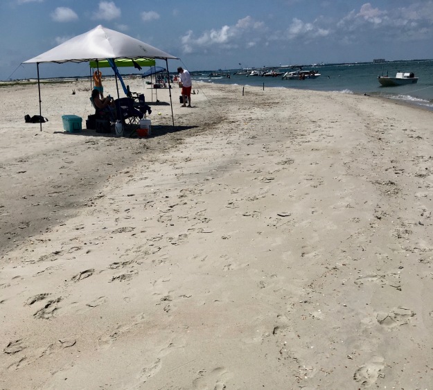
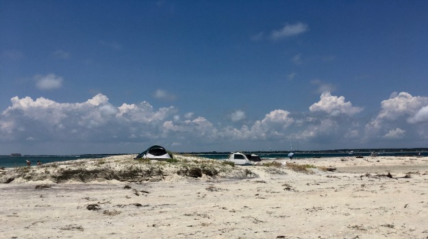
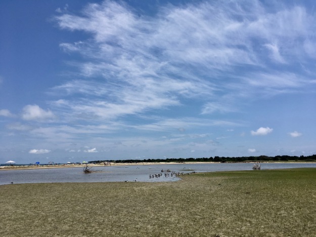
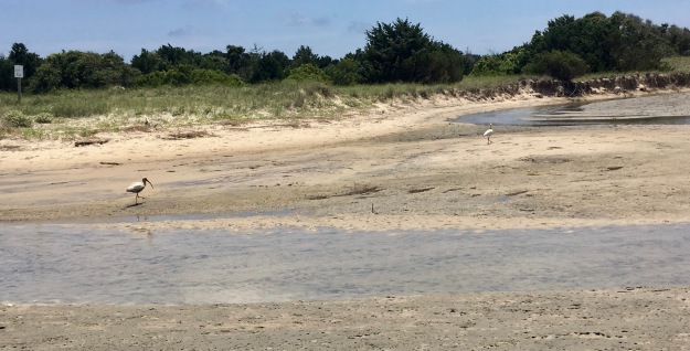
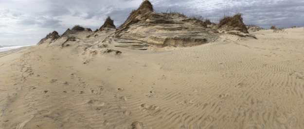
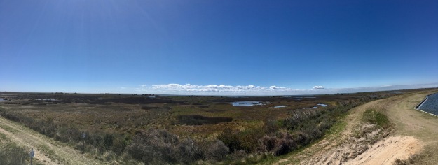
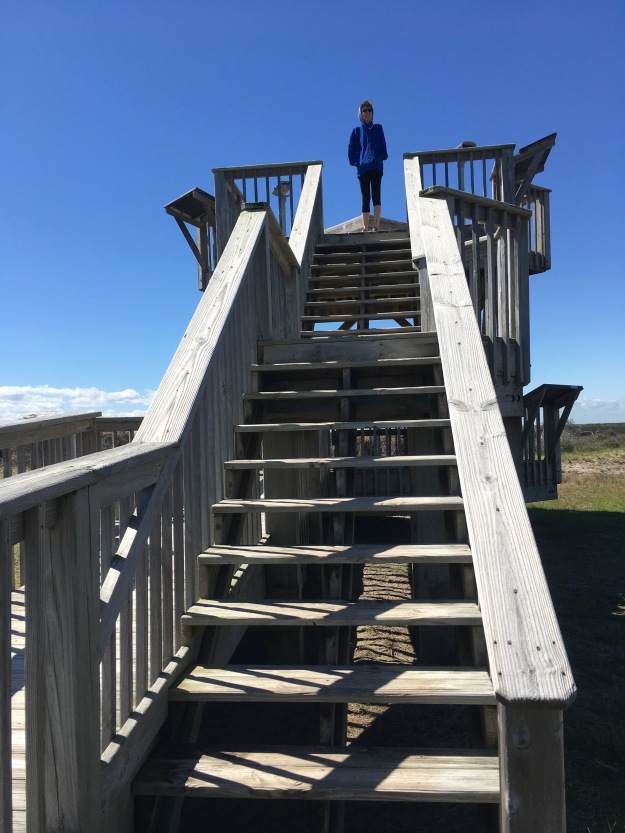
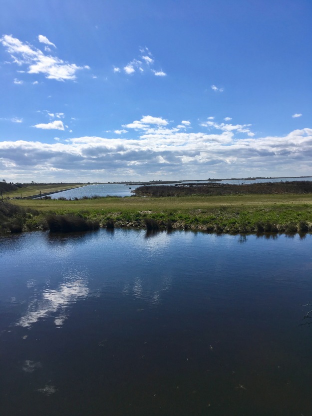
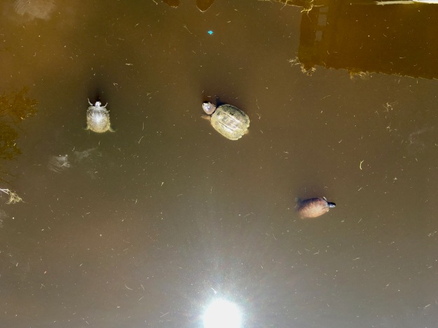
Here are some photos. Click on the picture, then select “slideshow.” For best results, change the time between slides to 10 seconds or more.
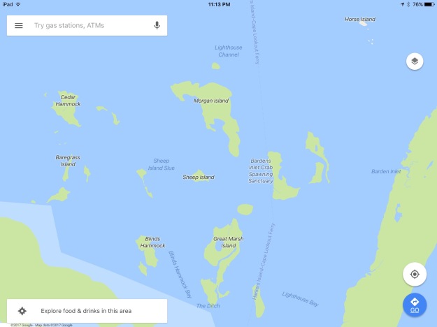
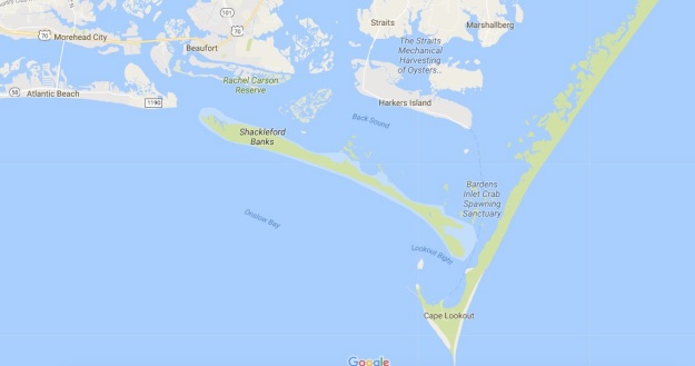
Atlantic Beach-Pine Knoll Shores, July 2012